|
MyCen Directions: CapSquare
|
Driving guide & ground directions with road maps, street pictures & information of the route, location or area
|
| Find Other Places: Directions & Map Index | Search For A Location | More Maps Here |
|
|
 MyCen Directions
Updated & Current
Clear & Accurate Maps
With Latest Landmarks
GPS Verified On Ground
Portal-Wide Useful Links
Picture Of Every Location
Comprehensive Information
Made With Local Knowledge
Each Place Visited In Person
Satellite & Google Earth View
Independent Opinion & Review

As Seen On TV's

|
|
|
|
|
If interactive map above is slow to load or not showing, CLICK HERE for static view
|
|
|
|
|
| View the Full MyCen Events Calendar here |
|
Address: Persiaran CapSquare,
Capital Square,
Kuala Lumpur, Malaysia
Postcode (Poskod): 50100 Kuala Lumpur
Tel: +603 2697 9788 (Management Office), +603 2697 9718 (Concierge Desk)
Fax:
Website: http://www.capsquare.com.my/
Area: Wilayah Persekutuan Kuala Lumpur, Federal Territory of Kuala Lumpur (KL / WP)
Jurisdiction: Dewan Bandaraya Kuala Lumpur DBKL - KL City Hall (See Local Govt)
Events At This Location: See MyCen Events Calendar
Directions: From Jalan Ampang, make a right turn on the one-way street just before the AIA building.
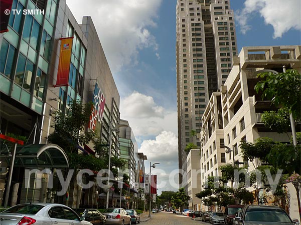
Info / Insights: CapSquare is the new entertainment, dining and shopping address located between Jalan Dang Wangi and Jalan Ampang. It is literally in the heart of the city. As a nightlife location, it fittingly stands on where the legendary Eastern Night Club and Cabaret stood during KL's decadent 60's and 70's. Within the stylish area is the CapSquare Residences - 6 CapSquare (www.6capsquare.com.my).
Cap Square is developed by Bandar Raya Developments Berhad - BDRB (http://www.brdb.com.my/).
Nearby Landmarks: Masjid India, Menara Multi-Purpose, Wilayah Complex, Asian Heritage Row
Surrounding Places: City One, Campbell Complex, Pertama Complex, Sogo, AIA Building, St John's Cathedral, St John's Institution, Convent Bukit Nanas, Medan Tuanku, Lebuh Ampang,
(use zoom and navigation buttons on top left of map to explore)
Surrounding Roads: Jalan Bunus, Jalan Tuanku Abdul Rahman, Jalan Dang Wangi, Jalan Kamunting, Jalan Raja Abdullah, Jalan Munshi Abdullah, Jalan Doraisamy, AKLEH
Nearby Hotels: Concorde Hotel, Renaissance Hotel, Maytower Hotel & Service Apartments,
Garden City Hotel, TuneHotels.com AirAsia Hotel KL (see Hotel Listings)
(For telephone contact, full address & web site of individual hotel, see our Hotel Listings)
Nearest Train Station: Dang Wangi LRT Station, Bandaraya LRT Station
Nearest Police Station: Balai Polis Dang Wangi
Bus Number:
Distance:
GPS Coordinates & Position: N3 09.272 E101 41.978
Featured Category: Properties
Related Categories: Real Estate Agents | Shopping Malls | Corporations
Connecting Maps: Asian Heritage Row | Bangunan Sultan Abdul Samad, Dataran Merdeka
St John's Church, Bukit Nanas | MaTIC, Jalan Ampang | Masjid India |
|
|
| Find Other Places: Directions & Map Index | Search For A Location | More Maps Here |
Please help us refine the location information by sending additional info, suggestions, updates, comments to tvsmith@mycen.com.my
Maps powered by Google Maps unless otherwise stated. Additional geographical information, overlays, placemarks, waypoints, data, pictures and design created & owned by Malaysia Central & TV Smith. All rights reserved. No warranty on validity, completeness or accuracy given or implied. Use at your own risk. Property names, place names, location mark, point-of-interest, business names, designs, signs, graphics, symbols, icons, brands & logos are trademarks of their respective owners. |
| queries: photo, pics, image, gis, place, places, attraction, guide, streetmap, roadmap, building, site, streets, directory, roads, public transport, travel, get, go, going, getting, drive, driving, walk, direction, journey, lrt, ktm, cab, whereabouts, locate, about, how to go, where is, far, near, shortest, find, miles, from, lokasi, gambar, tempat, cari, cara, macam mana, di mana, bagaimana, pergi, ke, jalan, bangunan, wisma, teksi, peta, panduan, arahan, arah memandu, pandu, alamat, tapak, berdekatan, perjalanan, dari, laluan |
|
|
|
|